3 amazing hiking/trail running spots around Guadalajara you shouldn’t miss
Discover 3 incredible hiking and trail running spots around Guadalajara, Mexico. From Bosque Primavera's volcanic trails to Barranca de Huentitán's 600-meter canyon and Lake Chapala's waterfalls, explore nature just minutes from the city.
Guadalajara is known as the cultural heart of Mexico and has been my home for the last year. It’s the birthplace of mariachi music, closely tied to the traditions of tequila from the nearby town of Tequila, amazing food and famous for its beautiful historic center with plazas, markets and colonial architecture. On top of all that, it has beautiful nature and landscapes surrounding the city.
Throughout this year I spent countless weekends exploring the hills, canyons and forests around the metropolitan area. I've learned that Guadalajara is an excellent place for trail runners, hikers and outdoor lovers. It offers a mix of different terrains, forests, volcanic rock and viewpoints overlooking the city gives you a lot of variety without ever having to drive far.
Here are my personal top 3 spots around the city for trailrunners and hikers.
Quick note before you go: Dangerous wildlife encounters are rare, but snakes and scorpions do live in these areas. They’re rarely on the trails, but it’s good to know what to do in case you run into one, especially if you’re going alone.
1. Cumbres Bugambilias, Bosque Primavera
This is my favourite spot in Guadalajara for trail running. It’s still not very well known, which means it’s usually quiet and peaceful. The route starts in the community of Bugambilias, where parking is easy. The main loop is 6.5 km with about 365 metres of elevation gain. You get a mix of steeper technical sections and flatter, easier parts, so I’d rate it as moderately challenging.
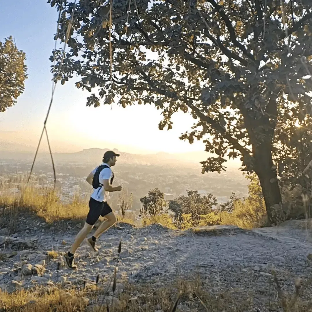
Along the way you’ll reach several viewpoints overlooking the entire city. Around sunrise the views are especially beautiful. Some stretches are wide and open, while others are tighter and surrounded by trees and bushes. You’ll also pass areas with volcanic obsidian, which is pretty unique for the region.
The trail is clean and well maintained, but it can be confusing at a few intersections because there are many side paths. Bringing a GPS device with the route loaded is a good idea so you don’t get lost. Expect the loop to take roughly 2 hours to finish at an easy to moderate pace.
If you wish to start running the mountains yourself I’d highly recommend a personalized training plan. I built a tool that generates a free training plan based on your goals, availability, and running level.
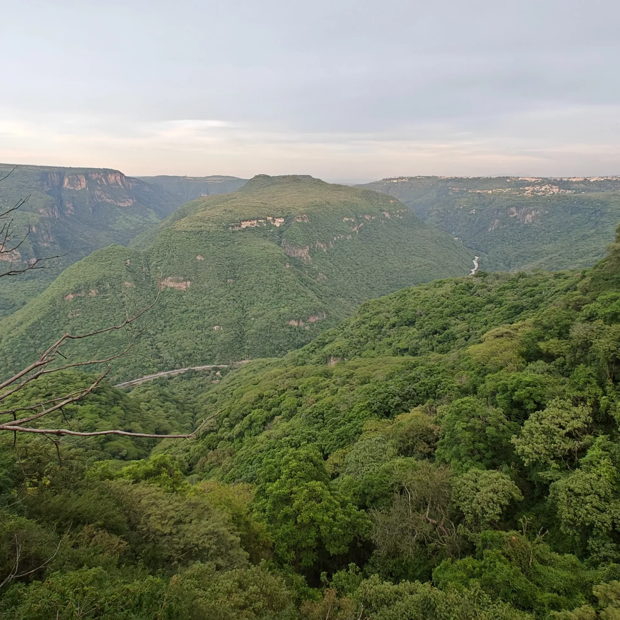
2. Barranca de Huentitán
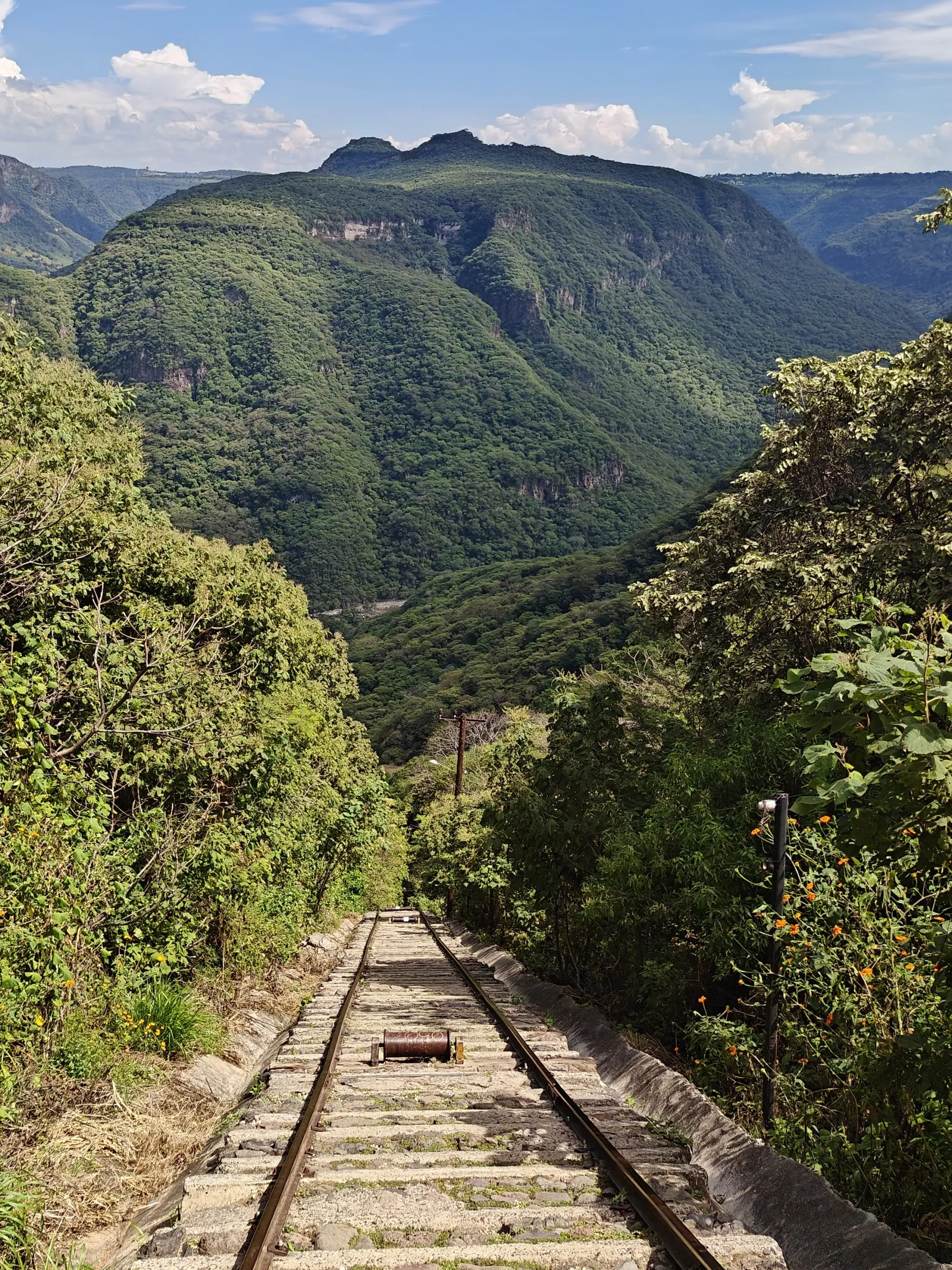
This is one of the most beautiful spots around Guadalajara, with huge canyon walls and incredible viewpoints. The Barranca (Spanish for Canyon) is roughly 600 metres deep, and the main route is a 10 km out-and-back down to the river and back up.
The best place to start is in Huentitán. At the trailhead you’ll find a small area with shops selling drinks and snacks. From here you can choose between two options: a well maintained zigzagging trail or the old abandoned incline railway, which is steeper and much more demanding. At the bottom of the canyon there’s a beautiful bridge that spans the river.
My recommendation is to take the zigzag path down. It’s safer, more scenic and you’ll pass several great viewpoints. Once you reach the river, you can cross the bridge and then head toward the abandoned village where the railway begins. Taking the railway back up brings you straight to your starting point. Just know that the railway is extremely steep in parts and requires good strength and endurance. If you prefer an easier climb, go back up the same trail you came down.
Overall, this is a moderate to hard route if you hike all the way to the bottom. It’s at its best during or after the rainy season, when everything looks green and alive. June through November is ideal. The route is clear and well marked, so it’s unlikely you’ll get lost. Most people take about 3 to 4 hours to complete it.
The only drawback is pollution. Unfortunately the river at the bottom is polluted and can smell unpleasant, and you might see more trash than in other areas. Apart from that, this is an excellent place for both hiking and trail running.
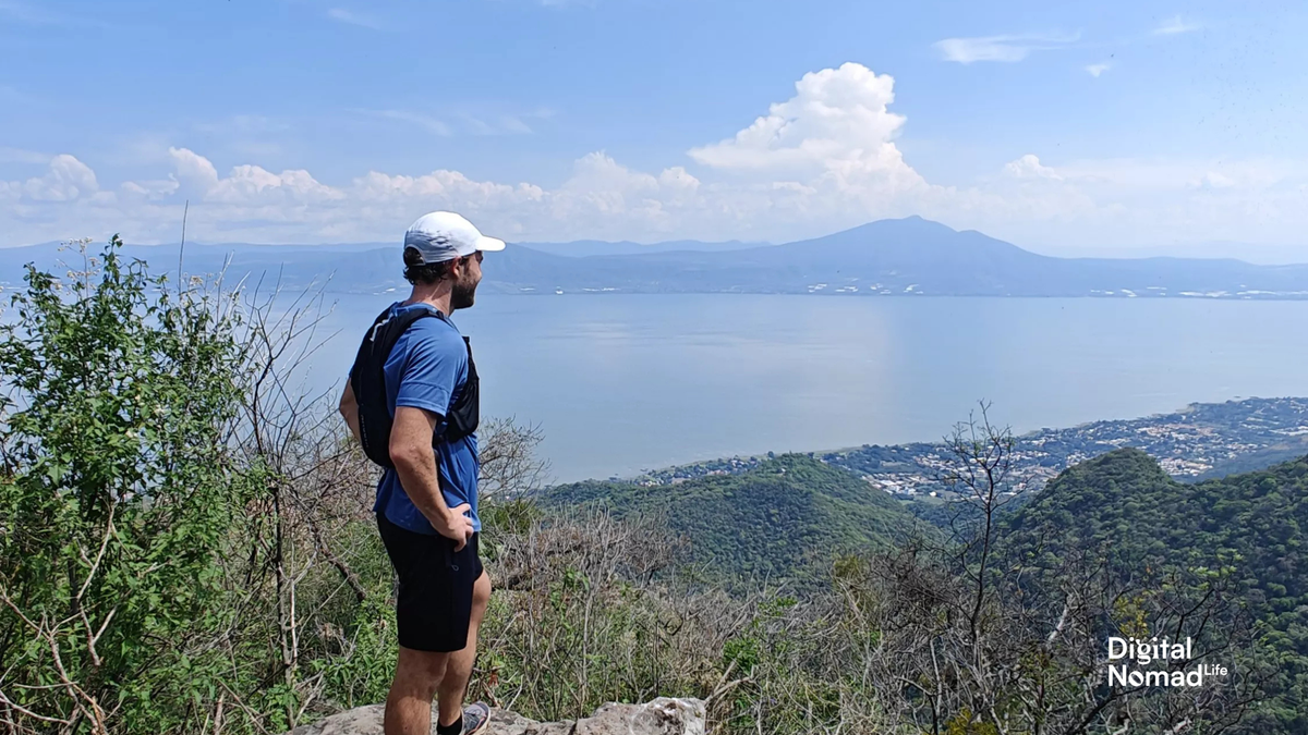
3. El Tepalo Ajijic
This hike starts in the beautiful town of Ajijic, a Pueblo Mágico (Magic Town) next to Lake Chapala, Mexico’s largest lake. It’s a little over an hour from Guadalajara by car, and it’s absolutely worth the trip.
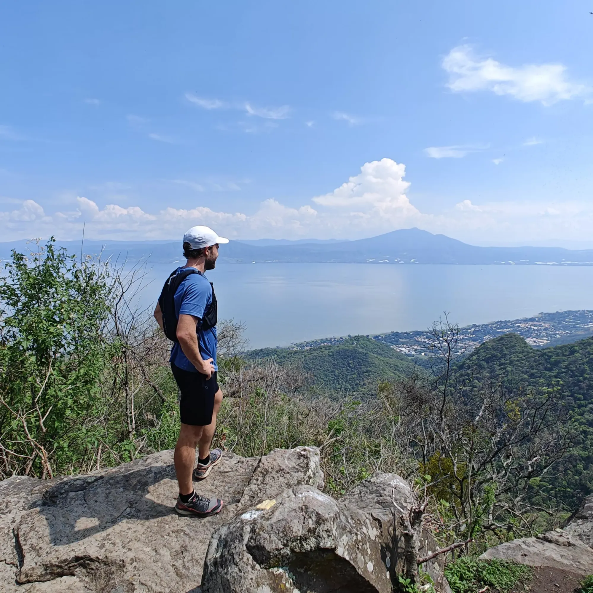
There are several route options, but my favourite is the hike to Las Tres Cruces. It’s a 6.4 km out-and-back with a significant 717 metres of elevation gain, so be prepared for a tough climb. It starts fairly easy and becomes more challenging as you go. Since it’s an out-and-back, you can always turn around earlier if you prefer a shorter route.
The landscapes on this trail are stunning. You’ll pass waterfalls, creeks and multiple viewpoints overlooking Lake Chapala. The route is very well marked with painted indicators on the rocks, so navigation is simple and getting lost is unlikely. Most people finish the full hike in about 2 to 3 hours.
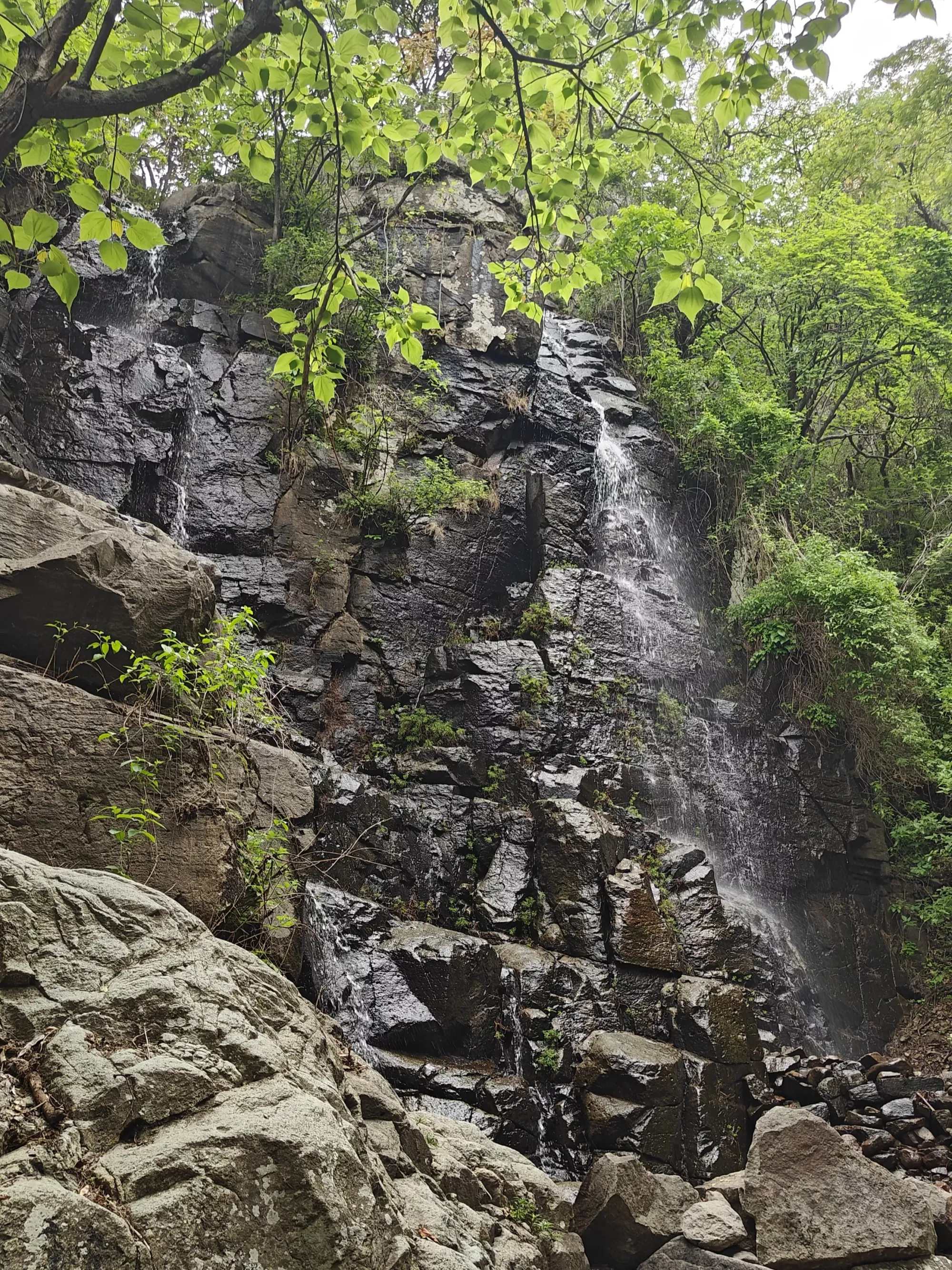
Overall I would rate this as a moderate/hard route depending on how far you are climbing up. In this route it is also recommended to do it during or right after the rainy season. The waterfalls will run dry in the dry season and it won’t be nearly as green.
Final Thoughts
After a full year of exploring these trails, I’ve come to appreciate how much variety Guadalajara offers right outside the city. Each spot has something different to give, whether it’s steep climbs, forest paths, volcanic rock, waterfalls or scenic views of the city, canyon and the lake. What makes it special is how accessible everything is. You can be on a trail in minutes and be surrounded by nature that feels far removed from the city.
These places have been a big part of my time living here. They’ve made training more enjoyable, given me a break from the routine and shown me sides of Guadalajara that many visitors never see. Whether you’re a runner, a hiker or just someone who wants a bit of fresh air, these spots are absolutely worth exploring.


Comments ()